What IS the name of that
creek?
Note:
The City map linked below does not render well in Netscape. Use Internet
Explorer to view.
-------- Original Message --------
Subject: [RL] Robla or Rio Linda Creek????
Date: Sun, 21 Apr 2002 20:15:44 -0700
From: "Erwin Hayer" <eeh625@hotmail.com>
To: ssheedy@cityofsacramento.org,
rogerd@saccounty.net
CC: dbrent@cityofsacramento.org,
hfargo@cityofsacramento.org,
karenz@saccounty.net,
petersonmi@saccounty.net,
ghelfip@saccounty.net,
kreinbergg@saccounty.net
riolinda@vrx.net
Subject: Robla or Rio Linda Creek????
Date: 21 April 2002.
Councilmember Sandy Sheedy and Supervisor Roger Dickinson,
I want to bring to your attention the confusion about a creek name within
your districts, Robla Creek, Rio Linda Creek, Linda Creek, Maple Creek,
Magpie Creek, what is the proper name?
The Creek that SAFCA, ARFCD, FEMA and the USACE call Robla Creek.
-
It is called Rio Linda Creek in the current edition of The Thomas Guide
Map of Sacramento County.
-
It is called Rio Linda Creek by the McClellan Park Environmental Management
Department.
-
It is called Linda Creek by the Sacramento County Bench Mark List.
-
The Sacramento Bee in an article on November 5, 1996 by Robert D. Davila
(CREEK NAME'S MURKY PAST - IS IT CALLED RIO LINDA OR ROBLA? RESIDENTS,
MAPS AT ODDS) listed Linda Creek, Rio Linda Creek and Robla Creek as names
it has been called.
-
Caltrans could not find Rio Linda Creek or Robla Creek on any of the official
road system maps in November 1996.
-
CSAA maps does not even give this creek a name.
-
It was called Maple Creek and then changed to Magpie Creek then changed
to Magpie Creek diversion canal by Television Channel 3 News when an airplane
had an emergency landing next to the Bike Trail on 27 March 2002. http://www.thekcrachannel.com/sac/news/localnews/stories/news-localnews-132855320020327-100312.html
-
About 3/4 of a mile of this creek passed through my parent's farm and since
1942, we always called it Linda Creek and when I first read about projects
in the vicinity of Robla Creek, such as the Hansen Lakes project, I had
a hard time finding the location.
-
On the current Sacramento City Council District 2 map, 21 April 2002, web
pages, [click
here for map] it is listed as Rio Linda Creek from the NEMDC or Steelhead
Creek to where it crosses into Sacramento County just west of Dry Creek
Road. Then the Magpie Creek Diversion Channel is now labeled Rio
Linda Creek and as you follow this creek east, it is labeled Rio Linda
Creek on the east side of Raley Boulevard. For some reason, I thought
this section upstream of Raley Boulevard with in the City of Sacramento
was Magpie Creek.
-
The creek within Sacramento County continues east and goes through the
north end of McClellan Park and the main branch continues to the west side
of Walerga Road and the Union Pacific Railroad tracks. This creek
and its branches drain almost all if not all of North Highlands through
Rio Linda. Linda Creek Park is just west of this creek south of E
Street in Rio Linda.
-
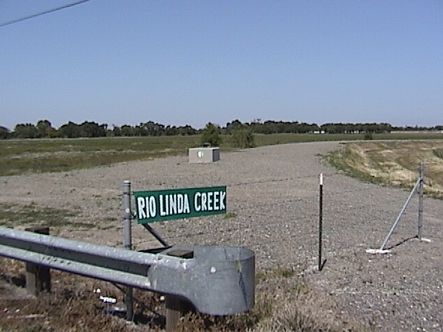
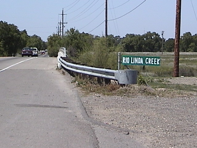
Now, 21 April 2002, a sign for the northbound Rio Linda Boulevard traffic
at the bridge crossing subject creek identifies the creek as Rio Linda
Creek, which agrees with the Sacramento City Council District Web Pages.
This portion of the creek is in the City of Sacramento. (See pictures
of sign below)
This has caused much confusion.
What are the chances that all the government agencies, news services,
fire departments, police departments, and map makers can get together and
agree upon a name for this creek so as to minimize confusion?
Erwin Hayer

View NE

View NW
>From the Rio Linda mailing list
Click here for other
Erwin Hayer links


